it would have missed the pool entirely.
*
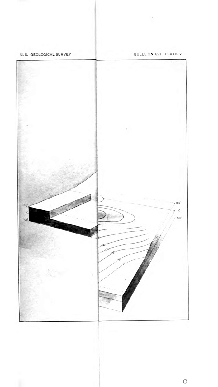
Plate V.
Illustrating section “Interpretation of Structure Contours” in Carroll H. Wegemann and Kenneth C. Heald, “The Healdton Oil Field, Carter County, Oklahoma.” in USGS Bulletin 621, Contributions to Economic Geology, 1915, Part. II. — Mineral Fuels. Washington, D.C., 1916 : 13-30
The accumulation of oil at Healdton is situated on an irregular structural dome or anticline about 4 1/2 miles in length by 2 miles in breadth, the long axis trending N. 62º W. The presence of the dome is not indicated by the topography.
*
The first well in the Healdton field, the greatest oil field yet discovered in the “Red Beds” area of Oklahoma, was drilled by the Red River Oil. Co. (now the Dundee Oil Co.) in August, 1913, on the farm of Wirt Franklin, in the NE. 1/4 sec. 8, T. 4S., R. 3 W. This well is on the southwest side of the pool, and probably had it been drilled a quarter mile southwest it would have missed the pool entirely...
*
tags: economic geology; those were the days; good fortune; structure;
Wirt Franklin (the farm of); Kenneth C. Heald; Carroll H. Wegemann