as to the results
*
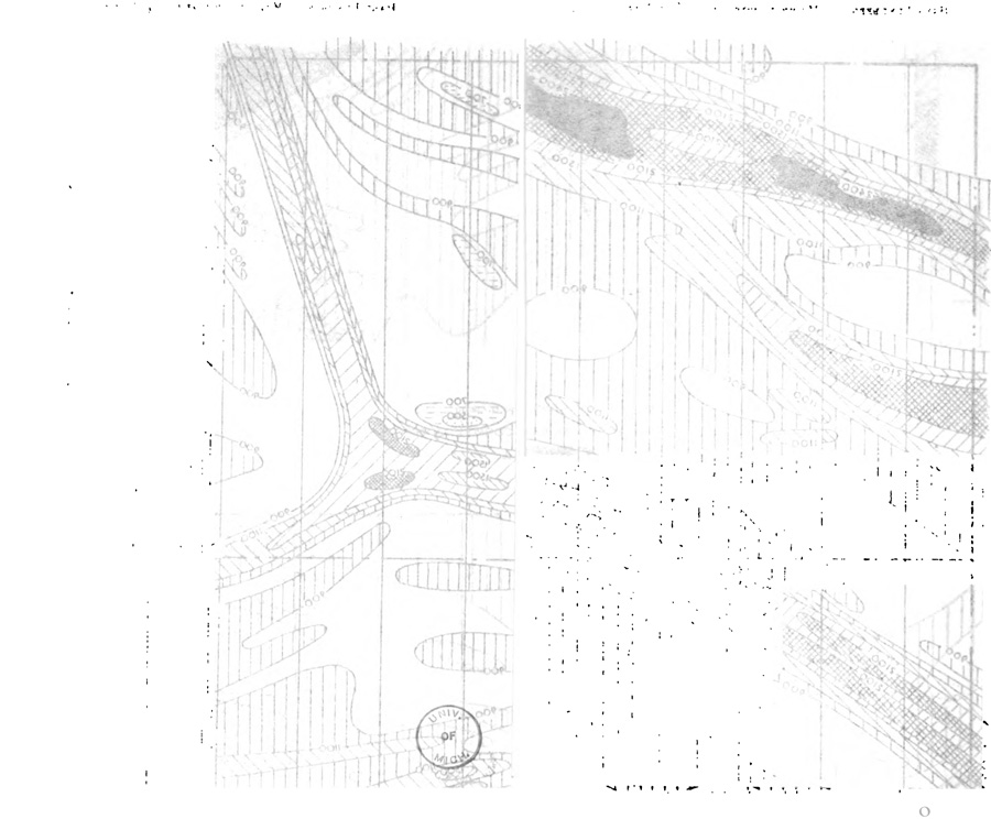
Plates I and II (showthrough, from their respective backs, here combined)
illustrating Hans Lundberg. “Magnetic Surveys with Helicopters.&rldquo; Bulletin, Institution of Mining and Metallurgy 488 (July 1947) : 21-28
copy at University of Michigan, digitized October 24, 2006
—
“Figs. 1A and 1B (Plates I and II) show two plans of an area in Quebec comparing the results of surveys of the vertical-field component obtained with an Askania balance on the ground, and the helicopter-borne magnetometer flown between 150 and 200 ft. above the ground. There are 28 miles of line, which had required some 70 days to prepare and magnetically survey on the ground. The same lines were flown and recorded in exactly one hour of continuous flying. While the flown results are somewhat less detailed, there is certainly sufficient information to serve as a guide for exploration work.”
p 23
tags: metallurgy; mining; H. Lundberg, “Magnetic Surveys with Helicopters” (1947)